Colorado River Heritage Greenway Park & Trails
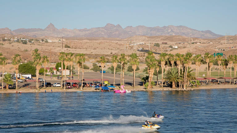
Visiting Laughlin without experiencing the mighty Colorado is a mistake no visitor should make, and only a few minutes devoted to exploring the Colorado River Heritage Greenway Park & Trails, you’ll see why. Located only a few minutes north of the Laughlin Strip, visitors can count on exploring 9 miles of new trails built to satisfy the outdoor enthusiast, or those simply looking to kick back with friends and family to drink in stunning Mojave Desert views.
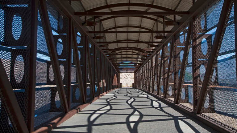
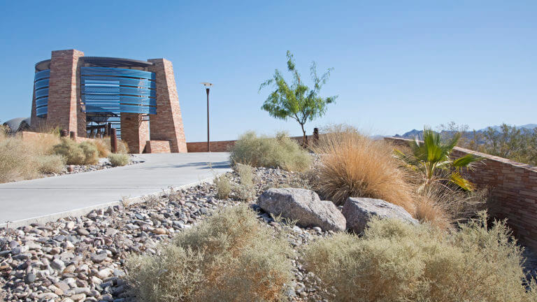
Since opening in 2012, this well designed parks and recreation area is under the watchful eye of the U.S. Bureau of Reclamation and is part of the greater Lake Mead National Recreation Area. The project includes three developed trailheads and a signature pedestrian overpass (that you’ll likely drive under as you enter downtown Laughlin) embraces and preserves the natural and cultural resources found within the area.
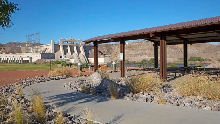
DAVIS DAM
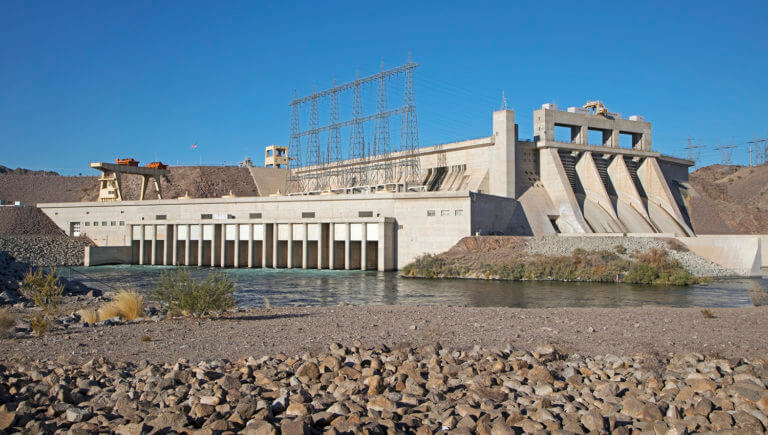
The Colorado River is a guaranteed attention grabber, so are views of the historic Davis Dam, which can be best appreciated at the north end of the park. Here, 70 miles downstream of the iconic Hoover Dam, the Davis Dam stretches across the Nevada-Arizona border and was completed in 1951. The main purpose of Davis Dam is to re-regulate releases from the Hoover Dam, to best manage the delivery of the Colorado River water south to Mexico. Despite the fact that Davis Dam is not available for public tours, the Colorado River Heritage Greenway Park & Trails itself is in a historic location important to the development of Davis Dam. Workers tasked with constructing the Dam lived in the area in various camps, and some lasting historic relics are accessible by the trail systems within the park. For a more complete rundown of these historic camps, the creation of Davis Dam, and early days in Laughlin, check out the Colorado River Museum & Historical Society, which is located directly across the river.
A RECREATIONALIST’S PARADISE
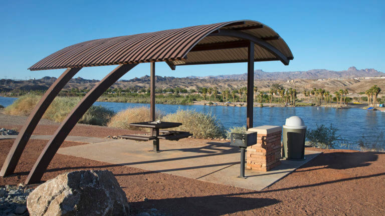
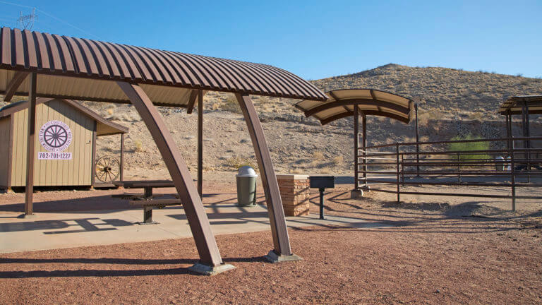
The Colorado River Heritage & Greenway Park has introduced 9 miles of trails, ideal for cyclists, pedestrian, and equestrian riders. Best yet, visitors to the area can enjoy the expansion of the Laughlin Riverwalk, fully developed restrooms and trailheads, picnic sites, shade shelters, fishing piers, and a highway pedestrian bridge overpass that provides direct access to the Colorado River.
ACCESSIBLE TRAILS
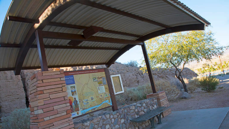
Visitors can count on exploring all parts of this parks and recreation area by several established trails. Five established trails stretch through the park, including the Bridge Trailhead, North Reach Trailhead, Equestrian Trailhead and Pyramid Canyon Trailhead. Four more trail systems lie within the park boundary:
RIVERFRONT TRAIL
- Distance: 1.7 miles
- Difficulty: Easy. This trail is comprised of a hard, packed surface that is relatively flat throughout. This trail is also handicap accessible, easily accommodating a wheelchair. Water is available throughout the trail.
HORSESHOE TRAIL
- Distance: 2.7 miles
- Difficulty: Moderate. The trail is made of native soil, perfect for horses, hikers, and mountain biking. No water is available throughout the trail.
DAM OVERLOOK TRAIL
- Distance: 0.8 miles
- Difficulty: Moderate. The trail is made of native soil, perfect for hikers or mountain bikes. No horseback riding is permitted on this trail, and water is not available.
DESERT TRAIL
- Distance: 2.8 miles
- Difficulty: Easy. This trail is relatively flat throughout and is a hard, packed surface. This trail runs through the desert, and native wildlife may be encountered and no water is available throughout the route. Ideal for horseback riding, hikers, and mountain biking.
For more information on this unique trail system, and details on planning your trip to Laughlin, please visit the Laughlin Visitors Center.
This Location:
City
LaughlinRegion
Southern Nevada