Alex Baker
Alex Baker
Mount Rose Wilderness Area
Picturesque Mount Rose comes by its name naturally. The late afternoon alpenglow that lays its rays across Mount Rose transforms the seasonally snow-capped peak into a gleaming, 10,776-foot geologic rose. It’s not uncommon to spy wistful stares from those in the surrounding lowlands as they look up toward the commanding monolith late in the day. Mount Rose is the crown jewel of the 30,000-acre wilderness area bearing its name, and the tallest Nevada-side peak in the Lake Tahoe Basin, anchoring Lake Tahoe’s eastern rim of the ridgeline.
Whether you’re hiking among wildflower-cloaked mountain meadows in the spring, peak bagging Mount Rose Summit during the summer, or snowshoeing and backcountry skiing the Mount Rose Meadows during the winter, this backcountry escape awaits a quick 40 minutes up the road from Reno.
Hiking Mt. Rose, NV
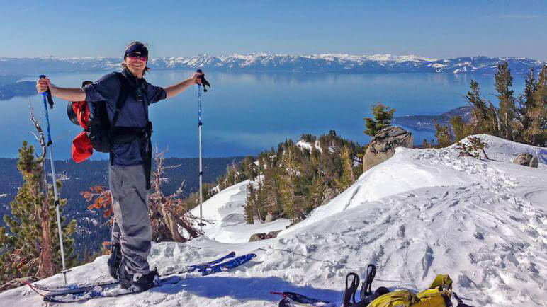
In the summer months, popular trails lead hikers all over the wilderness area and up to gob-stopping views atop Mount Rose Summit. From there, you get a magnificent 360-degree perspective marked by Lake Tahoe, distant peaks in the Sierra Nevada and the Silver State’s ranges, lush Carson Valley, Reno, and more.
Mt. Rose Summit Trail
Panoramic views of Lake Tahoe, Truckee Meadows, and Carson Valley await. This very popular trail leads to the headwaters of Galena Creek before climbing a sharp ascent to the summit. Be prepared for strong winds and changeable weather conditions—at any time of year—as you approach the wide-open summit.
Distance: 12 miles round trip
Elevation: 8,900′ to 10,776′
Difficulty: Advanced
Jones-Whites Creek Loop Trail
This hike up to the flanks of Mount Rose in the Carson Range offers a trail through Jeffrey Pines, mountain mahogany, and an 8,000-foot ridge overlooking meadows and valleys.
Distance: 9.2 mile loop through Mt. Rose Wilderness
Elevation: 6,200′ to 8,300′
Difficulty: Intermediate
Whites & Thomas Creek Canyons
Trails, including the Dry Pond Trail, are available in two canyons. Both canyon trails access Mt. Rose Wilderness. Two trails and trailheads were recently constructed at Whites and Thomas Creek canyons. The new Pond Trail connects the two canyons and provides outstanding views of Reno, Washoe Valley, and Mount Rose. Hikers flock to Thomas Creek, where they find a rolling stream slicing through a scenic, aspen-filled canyon. The autumn colors are magnificent. In the spring, the meadow is carpeted with wildflowers.
Distance: 8 miles of trails available in two canyons.
Elevation: 7,400 to 9,800
Difficulty: Intermediate
Hunter Creek
The trail parallels the Hunter Creek Canyon. Hikers will find a number of rewards, including evidence of Nevada’s hard-working beaver population and a 30-foot-tall waterfall waiting at the end.
Distance: 7 miles round trip
Elevation: 5,000′ to 6,000′
Difficulty: Intermediate to advanced
Backcountry Skiing, Snowboarding & Snowshoeing at Mount Rose in Nevada
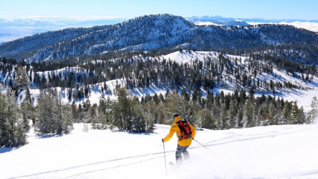
When the snow falls, the mountainsides become a backcountry bonanza. The Mount Rose Wilderness includes meandering snow fields, challenging steeps, open bowls, and numerous chutes and basins. Stick on your skins, flick on your avalanche beacon, pick a line, and climb to the top. You may even want to save your lunch break until you come across the tiny, inconspicuous hut that straddles Contact Pass.
Meanwhile, snowshoers, Nordic skaters, and the lovable tribes of bonsai sledders and tubers all congregate around Mount Rose’s many bowls and sled runs, many of which can be found directly off of Mount Rose Scenic Byway on Nevada state Route 431, the only highway that stretches directly through the Mt. Rose Meadows over the Sierra Nevada’s highest year-round pass. The Mount Rose Meadows and Chickadee Ridge falls just outside, but adjacent to the Mount Rose Wilderness Area boundary line.


Tamarack and Incline Peaks are also popular destinations, and advanced groups can reach the summits of both peaks in about an hour. Another favorite is Rose Knob, which has a trailhead fewer than 10 minutes from Incline Village. If you want to hit the backcountry in relative solitude, Relay, Houghton, and Mount Rose peaks see fewer than half the skiers than the closer locations get, making it easy to escape the crowds.
Travel Nevada Pro Tip
Chickadee Ridge
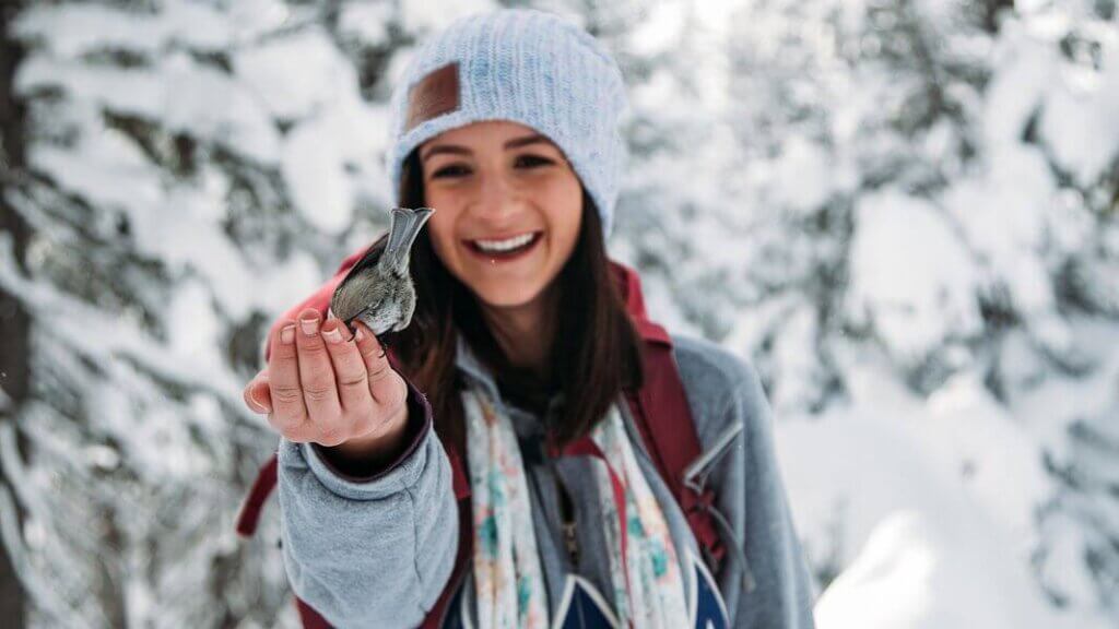
Though Mount Rose Meadows is a magnet for wintertime recreation of all types, one you won’t want to miss is the snowshoe trek into Chickadee Ridge. Situated just outside the Mount Rose Wilderness Area in the Mount Rose Meadows, Chickadee Ridge is aptly named for the friendly resident songbirds that live in the trees along a ridgeline offering incredible views of Lake Tahoe—anyone making this 2 mile round trip trek will undoubtedly get in touch with their inner Snow White in all the right ways. Hike up to Chickadee Ridge during the summer months, or snowshoe into this incredible experience during the winter. Here, wild chickadees will fly down from their nests and land right in your hand, if you can believe it.
Travel Nevada Pro Tip
Hours:
You can visit Mount Rose Wilderness and adjacent Mount Rose Meadows year-round for hiking, skiing activities, and more.
Admission:
Fees are not required for any day or overnight use of the Mount Rose Wilderness area, though campfire permits are required. For most up-to-date information on seasonal access, be sure to connect with the USFS Carson Ranger District at (775) 882-2766.
This Location:

City
North Lake TahoeRegion
Northwestern
