Get a little out there and explore the heart of Nevada’s unexpected wilderness. With its thousands of miles of trails, the Silver State offers hikers and backpackers of all skill levels a lifetime’s worth of exploration. Walk through slot canyons carved by time, climb alpine ridges above the treeline, or trace old railroad paths with desert valleys stretching out in every direction. No matter where your boots land, the landscape always finds a way to surprise you.
Hiking in Nevada
Find the Best Hiking in Nevada
It’s wild out there—in all the best ways. Nevada’s trails can take you across sunbaked sandstone, into shaded alpine forests, and through wide-open desert where the horizon keeps shifting. Wherever you’re headed, be sure to pack smart: good boots, plenty of water, and more sunscreen than you think you’ll need.

There are no items matching your search.
Recreate
Responsibly
Responsibly
Love this place? Learn what you can do to help keep the land we all care about accessible for future generations.
Northern Nevada Hikes
The Biggest Little City is surrounded by big hikes—and plenty of quick ones, too. Local favorites like Hunter Creek Trail and Galena Creek Trail are easy ways to get into the alpine air without straying too far from town.
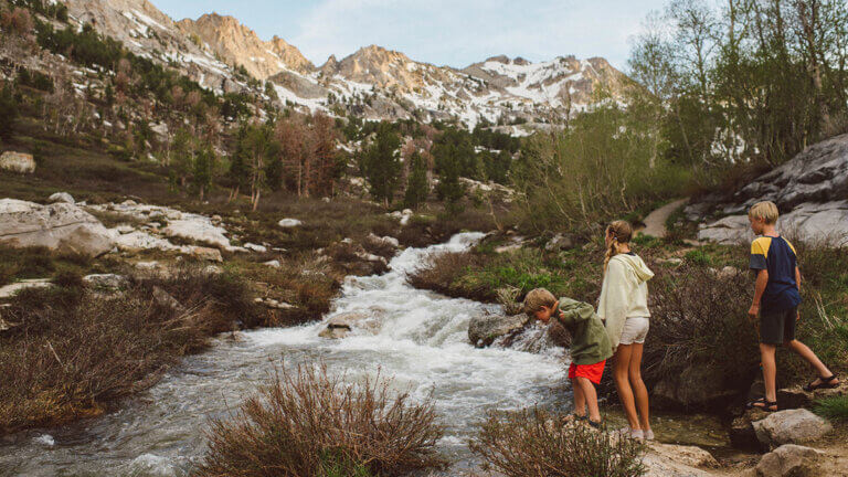
For a wider view, head into the Mount Rose Wilderness Area, where the trail to the 10,766-foot summit winds past waterfalls and wildflowers before topping out with panoramic views of Lake Tahoe, Washoe Valley, and the city below. Along Tahoe’s northeast edge, the Marlette Lake Trail in Spooner Lake & Backcountry State Park is a scenic climb through tall trees and quiet ridgelines, ending at a glimmering alpine lake surrounded by peaks.

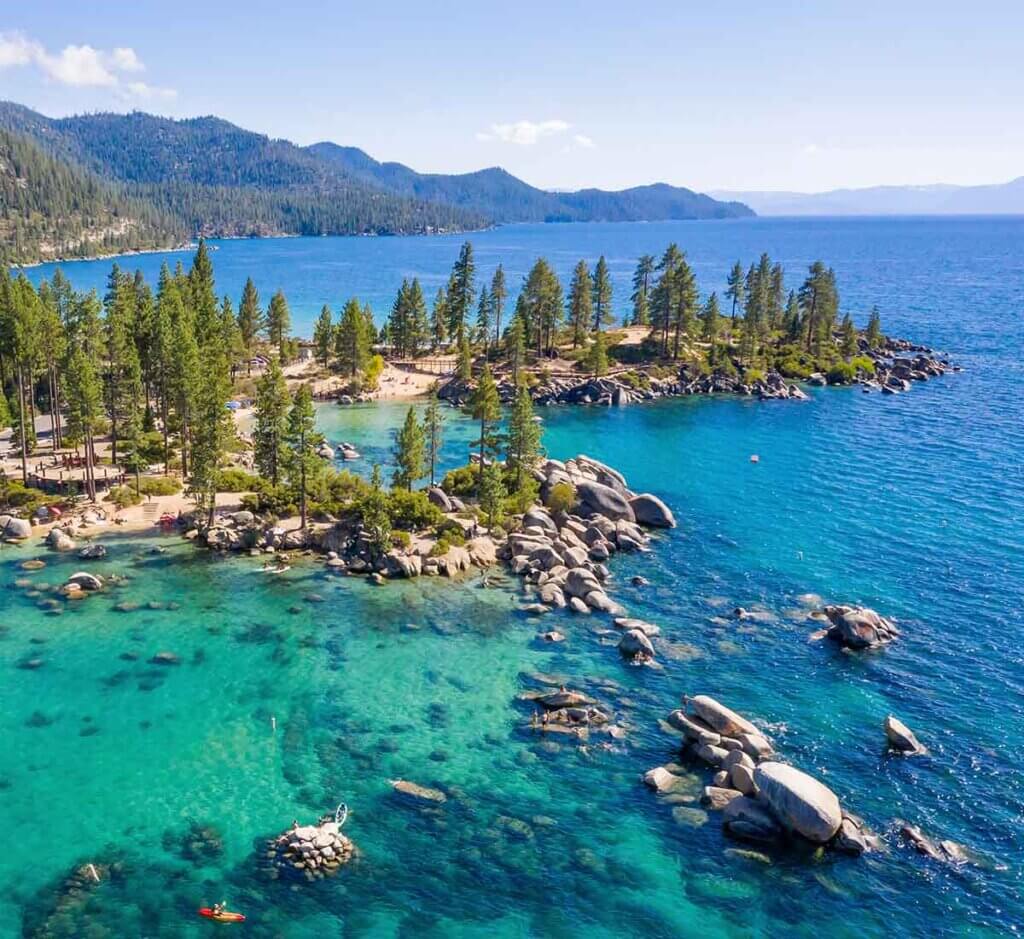
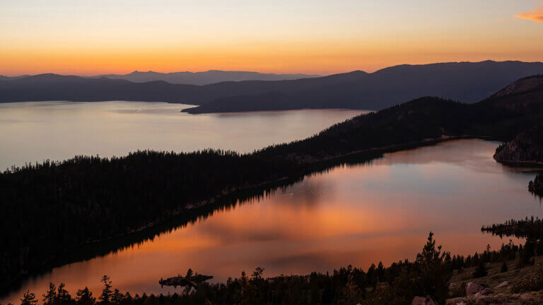
The Lake Tahoe Basin holds hundreds of miles of trail, each one offering its own kind of perspective. You might ease into it with a paved stroll on the East Shore Trail or pack up for a multi-day loop along the Tahoe Rim Trail. Wherever you go, the lake keeps appearing—sometimes between trees, sometimes all at once, blue as can be.
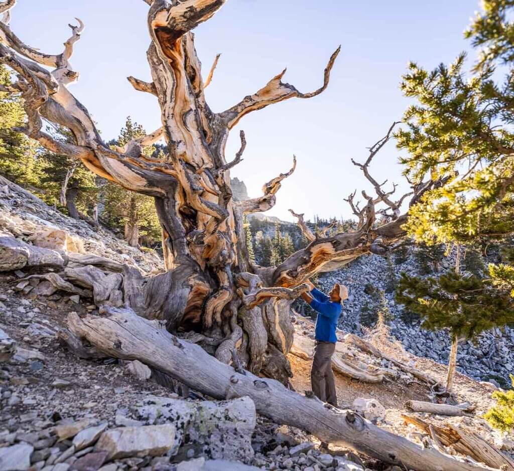
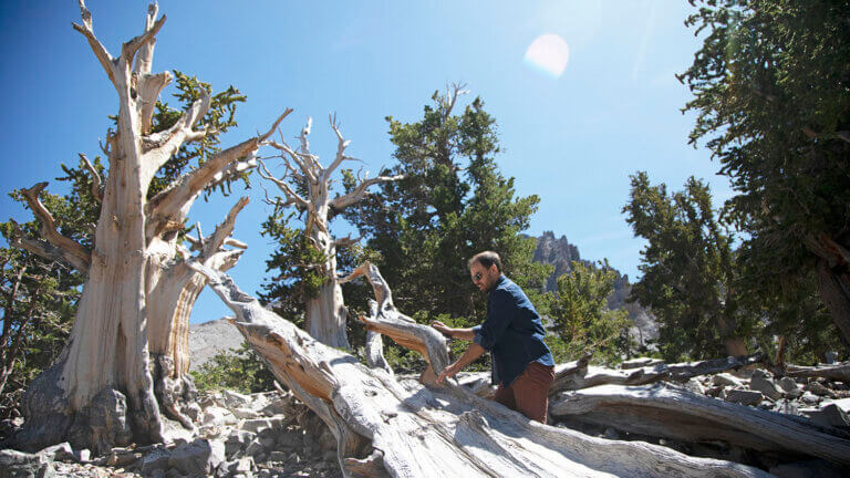
And for those looking farther out, Great Basin National Park in eastern Nevada delivers something few places can match. Trails here pass bristlecone pines that have weathered thousands of years and climb into high alpine country where lakes, caves, and wide-open stargazing reward every step.
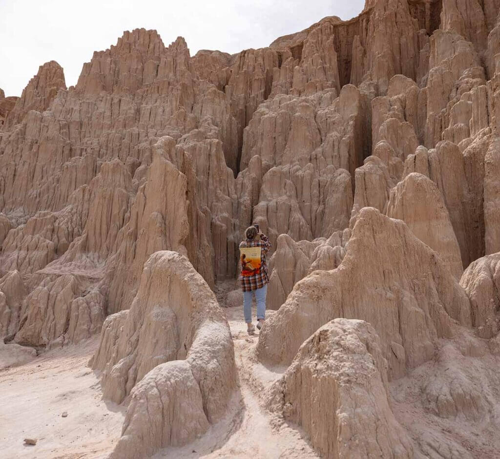
For those seeking an anything-but-ordinary hiking experience, trails in Cathedral Gorge State Park offer stunning slot canyons and otherworldly landscapes.
Travel Nevada Pro Tip
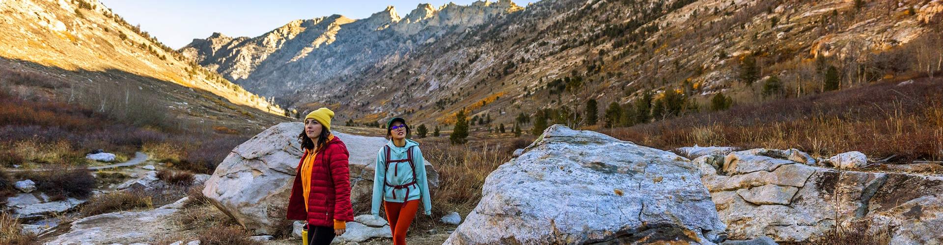
Looking for some wilderness where you’re practically guaranteed to have the trail to yourself? Head for the Toiyabe Crest Trail—a 75-miles, timberline-skirting journey along the stunning Toiyabe Range.

Looking for a Trail?
View and download up-to-date maps, descriptions, and directions for thousands of miles of Nevada trails for hikers, mountain bikers, equestrians, OHV riders, and more.
Southern Nevada Hikes
Hiking near Las Vegas? You can bet on that.
Just 45 minutes northwest of the city, Mt. Charleston climbs nearly 12,000 feet above the Spring Mountains National Recreation Area. Trails here lead through aspen groves, alpine meadows, and ancient bristlecone pine forests—one of the largest concentration of them in the West. On a clear day, you can spot both Red Rock Canyon and the Las Vegas Strip from high above.
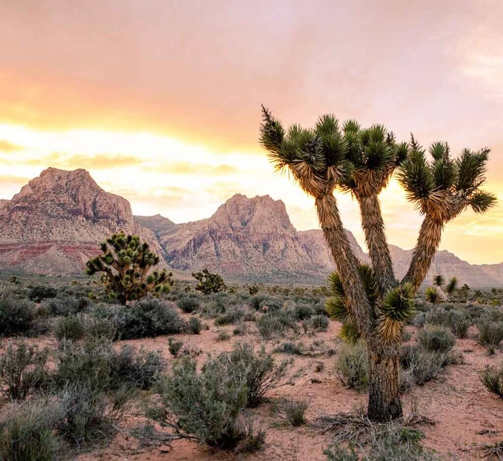
Closer to the city, Red Rock Canyon National Conservation Area sprawls across rust-colored cliffs and winding canyons. The trails here range in difficulty but share a common thread: big views, quiet pockets of nature, and an easy escape into the Mojave.
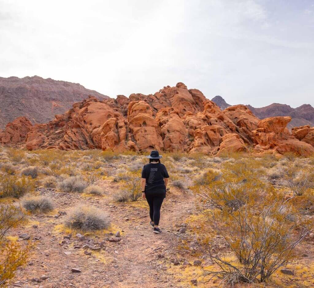
Valley of Fire State Park, about an hour northeast of Las Vegas, lives up to its name with sandstone formations that shift color as the light changes. Trails like Fire Wave, Rainbow Vista, and White Domes show off the park’s wild side, where petroglyphs and slot canyons reward the curious.
If your boots like a bit of backstory, the Historic Railroad Tunnel Trail near Boulder City offers just that. The path guides hikers through five tunnels carved into the rock during the construction of the Hoover Dam, with Lake Mead stretching out below. Nearby, Lake Mead National Recreation Area features plenty of other hikes, too—along shorelines, through desert canyons, and up ridgelines where bighorn sheep might just cross your path.
Rural Nevada Hiking
Getting a little out there means finding Nevada adventures beyond Vegas and Reno—hiking included.
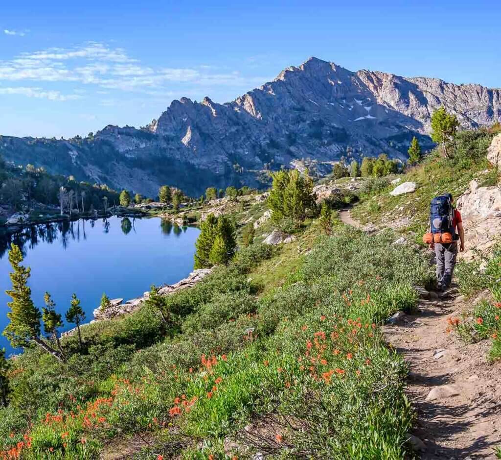
One of America’s most underrated national parks, Great Basin National Park offers panoramic views from its pleasantly uncrowded hiking trails. The 4.8-mile out-and-back Bristlecone-Glacier Trail rolls past gnarled bristlecone pines to a stark, rock-rimmed cirque set below Nevada’s last glacier. The Wheeler Peak Trail climbs to an impressive 13,161 feet, and hikers who summit the mountain are rewarded with one of the state’s most dramatic vistas. For a gentler stroll, take the 2.7-mile Alpine Lakes Loop, which serves stunning views of ruggedly beautiful alpine lakes set against some of Nevada’s tallest peaks.
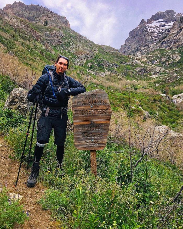
The Ruby Crest National Recreation Trail follows the spine of one of Nevada’s most pristine ranges: the Ruby Mountains. Its sole paved access point—the picturesque Lamoille Canyon—sees its fair share of day-trippers and overnight visitors.
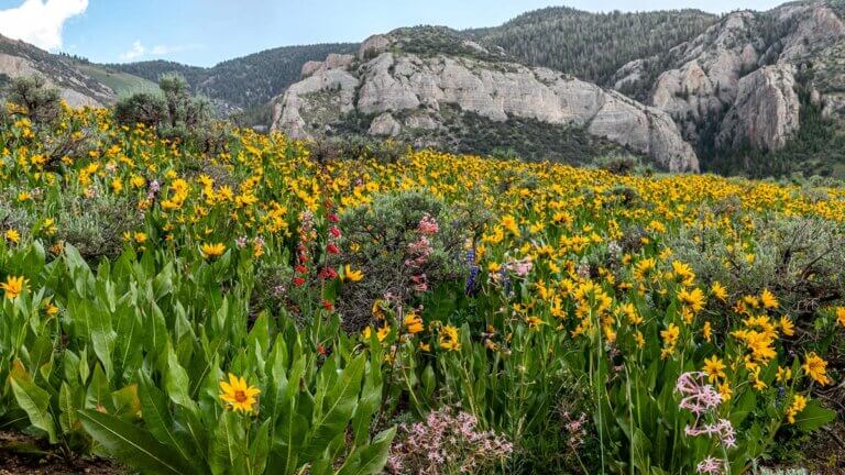
Ready for a northeastern Nevada adventure into one of the most remote areas in the Lower 48? The Jarbidge Wilderness Area offers some of the best hiking in Nevada alongside incredible fishing and stargazing opportunities. Just shy of the Idaho border, its 10,000-foot peaks—dressed in wildflowers and glacier-carved canyons—feature 150 miles of hiking trails and even a dose of Wild West history in the historic town of Jarbidge.
#TravelNevada
Share scenic trailside snaps with #TravelNevada. If we love your photo, you might see it here.