Silver State Scenic Byways Sure To Get Your Motor Runnin’
Whether it’s on pavement or in the backcountry, on two wheels or four, in desert canyons or alpine paradise, Nevada’s got a scenic byway with your adventure-mobile’s name all over it.
There’s no debate: Nevada is the Road Trip Capital of the USA—for both pavement pedallers and those who’d rather drop a gear and disappear into the wild multi-hued yonder. And that’s why we’ve carved out ten classic slices of the Silver State into official Nevada road trips.
However, no matter what corner of the Silver State you find yourself in, and no matter how much time you have, as long as you’ve got wheels, we’ve got a stretch of road—some short and paved, others long and rugged—to (and through) some place truly unforgettable. From national scenic byways and state scenic drives to BLM-designated backcountry byways, map out this array of Nevada routes that are worth far more than the drive.
Recreate Responsibly
Love this place? Learn what you can do to help care for the land we cherish and keep it accessible for future generations.
If it’s “my way and the scenic byway,” we’ve got a road (or 15) for you.
Scenic Byways: Valley of Fire, Lake Tahoe & Mount Rose, Angel Lake, Lamoille Canyon, Mt. Charleston, Las Vegas Strip, Pyramid Lake
Scenic Drives: Red Rock Canyon, Wheeler Peak, Success Loop
Archaeological. Cultural. Historic. Natural. Recreational. Or scenic. All it takes for a road to be officially designated a “scenic byway” is one of those “intrinsic qualities.” Nevada travelers know that every Silver State adventure involves at least all of those. Maybe that’s why we have seven.
1/1
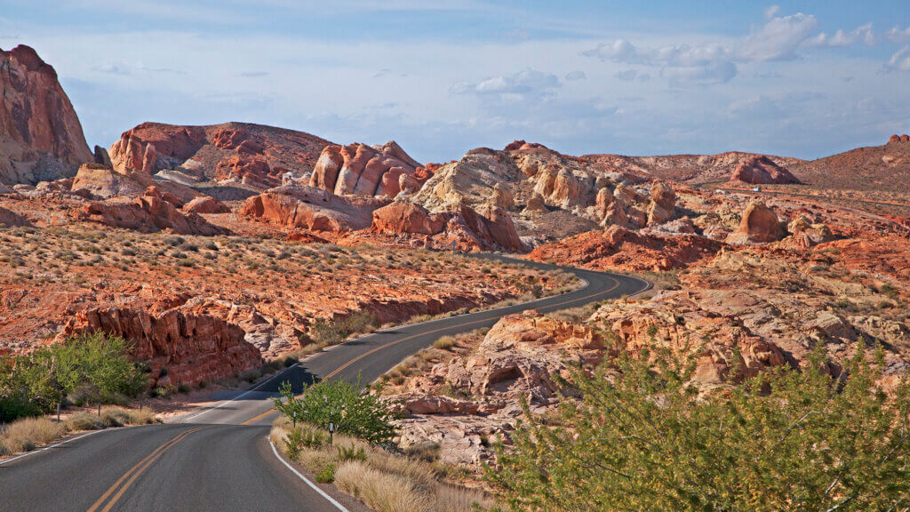
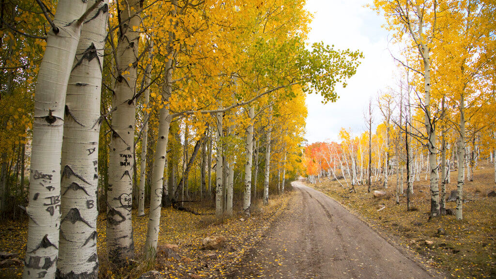
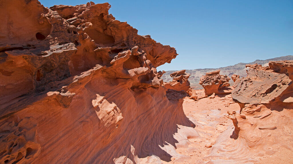
Valley of Fire Scenic Byway
This one may be the most breathtaking eight-mile drive you ever take. Roll through narrow canyons lined by glowing red sandstone, wind-sculpted into dramatic shapes—serious Harley Davidson commercial territory. Be sure to pull off and traipse trails to arches, striped rock formations, and overlooks of Nevada’s oldest and largest state park—all of which will prove to you why it also remains our most famous. [8 mi / 2+ hr]
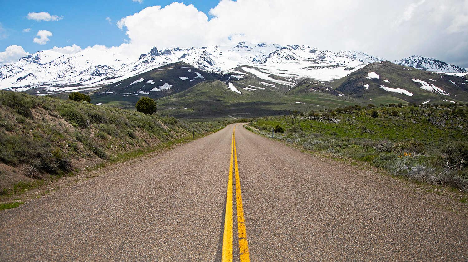
This one’s a twofer. From Reno, cruise 4,000 feet up the twisty Mt. Rose Highway (SR 431), over the Sierra Nevada’s highest year-round pass (8,911 ft). At the summit, trade panoramic views of the Great Basin for those of America’s most beautiful lake, then catch SR 28 for a breathtaking ride around Lake Tahoe’s unbeatable “Nevada Side.” Want a proper road trip? Continue along the Lake Tahoe Loop. [53 mi / 1.5 hr]
Short but mighty SR 231 (AKA Angel Lake Road) begins in Wells and rises several thousand into the East Humboldt Range, up from the sagebrush-swept high-desert to the glacially cut paradise that is Angel Lake. Ascend through groves of piñon pine, mountain mahogany, and aspen as Angel Creek flows downward, while keeping your eyes peeled for bighorn sheep, mountain goats, pronghorn antelope, and more. [12 mi / 30+ min]
The road up this glacier-cut jewel of the Ruby Mountains stuns as it crawls up to 8,800 feet along rushing Lamoille Creek, framed by bursting wildflowers, seasonal waterfalls, and sky-scraping 11,000-ft peaks, home to mountain goats, bighorn sheep, and Himalayan snow cocks, to name a few. Pause for intriguing interpretive panels, and pack your boots for some of the best hiking this side of the Rockies. [12 mi / 45+ min]
If you want to traverse seven climate zones in one go, you could drive from Mexico to Canada. Or just cruise up this scenic byway from the Mojave Desert scrublands to a mountain town ensconced by nearly 12,000-foot peaks—which sits just 45 minutes from Downtown Las Vegas. At the top, treat yourself to trails past some of the planet’s oldest trees, as well as to southern Nevada’s only winter sports action. [40+ mi / 2+ hr]
It’s true. In 1995, the Federal Highway Commission named Las Vegas Boulevard America’s first (and, to this day, only) “nighttime scenic byway.” And why not? The busy main drag bisecting the Strip rolls (sometimes crawls) past some of the wildest “scenery” on Earth—illuminated by more than 12 million light bulbs, outlandishly groundbreaking architecture, and truly unparalleled people watching. [4.5 mi / 30+ min]
Launch north from Fernley and trace the Truckee River to its terminus at a lake nearly as big as its source, Lake Tahoe, but with a fraction of the crowds. Even bigger than Tahoe are the uninterrupted views—including of the 400-foot-tall pyramid-shaped rock for which this sapphire jewel was named—and the fish; this is prime angling territory for salmon-sized Lahontan cutthroat trout. [30 mi / 1+ hr]
“Scenic drive:” a drive that’s scenic. Sounds simple, right? Well, here in Nevada, it’s not. But only because, with the astounding range of terrain in our humongous state, the definition of “scenic” is just too damn diverse to pigeonhole. So here are three totally different slices of scenery that you’ll want to add to your to-drive list right away.
1/1
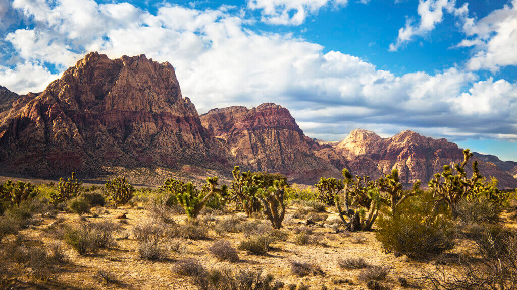
Red Rock Canyon Scenic Drive
There’s a reason this scenic drive requires $15 and a timed entry reservation: it’s worth it. Millions of Las Vegas-area visitors are in no way wrong about escaping the Strip to immerse themselves in the mountain majesty that most tourists only see from their “mountain view” hotel rooms, which astounds with multi-hued sandstone peaks, lush oases, and wildlife-studded trails to ancient petroglyphs. [13 mi / 1+ hr]
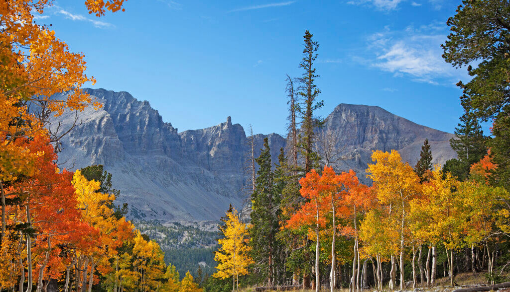
The NPS calls it “driving into the clouds.” Probably because you climb 4,000 feet from a wide-open sagebrush steppe to a 10,000-ft alpine wonderland atop rarely crowded Great Basin National Park. Wind past panoramic views of 13,065-ft Wheeler Peak (Nevada’s 2nd tallest) en route to bristlecone pines—the world’s oldest trees—glacially carved lakes and cirques, and the best stargazing in the Lower 48. [12 mi / 40+ min]
Not to play favorites, but… Beginning at 7,300 feet in Cave Lake State Park, this jaunt ditches pavement through the wildflower-blessed Schell Creek Range via quaking aspen groves (some doubling as arborglyph galleries) and sweeping high country views, including from a summit just shy of 9,000 feet, on its way to the frozen-in-time town of McGill. Watch for foxes, bighorn sheep, and even mountain lions.
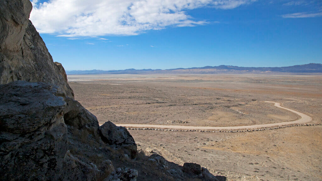
The Bureau of Land Management classifies backcountry byways into categories, based on a road’s surface and the kind of vehicle you need to cruise over it. With Type I, we’re talking pavement or at least an all-weather surface that you can drive in a regular “touring car.” Whereas, with Type II, you better hop in a high-clearance rig, preferably with 4×4, to navigate that dirt. Let’s just say, we don’t have a lot of Type I in this state. So brush up on the Dirt Road Code and leave that asphalt in the dust.
1/1
Gold Butte Backcountry Byway
This extremely remote, rugged route traverses Gold Butte National Monument, a stunning slice of pure Mojave desert backcountry. Motor past colorful sandstone, thousands of ancient petroglyphs, and dreamlike formations like Little Finland that seem to ignite as the sun sets over nearby Lake Mead. Views out here extend to Valley of Fire to the south and Grand Canyon–Parashant National Monument to the north. [Type II – 62 mi / 5+ hr]
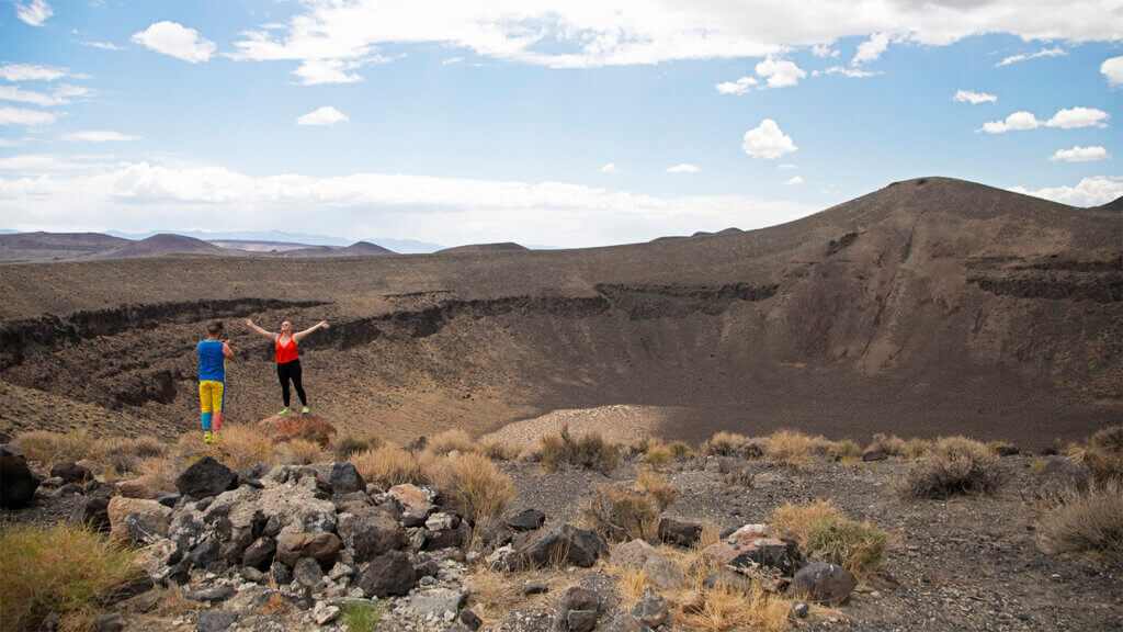
Wildflowers and wildlife abound on this remote central Nevada route to a massive volcanic crater, located about halfway between Tonopah and Ely. This otherwordly site became one of Nevada’s six National Natural Landmarks in 1973 and is famous for being a NASA-designated “Terrestrial Analogue Site” used as a training ground for astronauts on lunar missions. Scan the horizon for 20 other extinct volcanoes, too. [Type II – 24 mi / 2 hr]
Pick up a free driving tour brochure from Lovelock’s Marzen House Museum before rumbling along what used to be the bottom of ancient Lake Lahontan en route to this important archaeological site. At the cave—150 ft long and 35 ft wide—interpretive signs tell the stories of the 2,000-year-old artifacts found here, including baskets, textiles, and tule duck decoys (Nevada’s official state artifact). [Type I/II – 20 mi / 2+ hr]
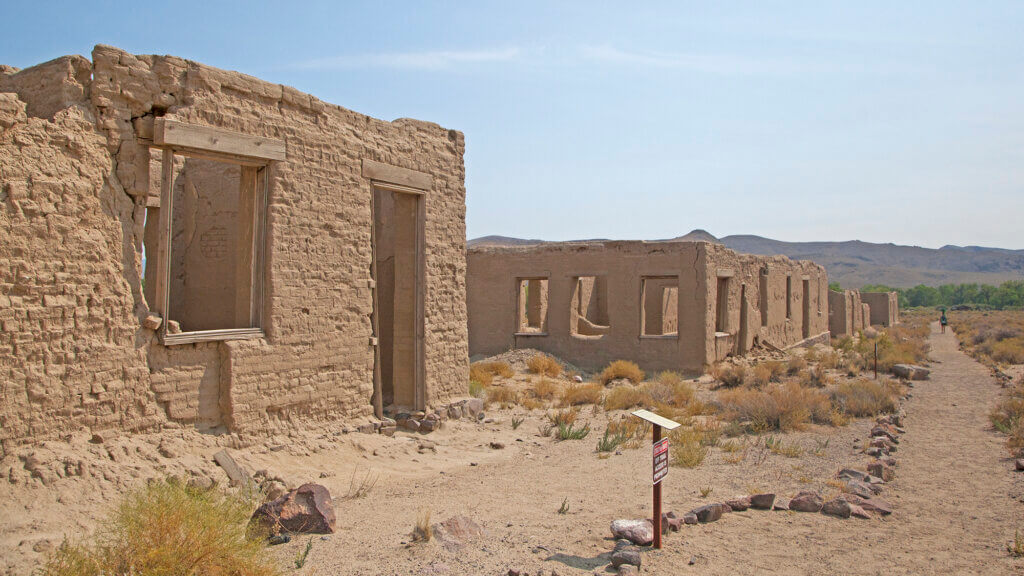
Follow in the hoof-steps of the Pony Express, which Fort Churchill was established to protect back in 1860. The route begins at Fort Churchill State Historic Park, following the tree-lined Carson River for 21 miles (Type I) before climbing above Eldorado Canyon on a rugged 29-mile stretch (Type II) through the Pine Nut Mountains and down to the riverfront town of Wellington. Bring an atlas for this one. [Type I/II – 67 mi / 4+ hr]
1/1
Travel Nevada Pro Tip
When traveling Nevada’s spectacular backroads, tracks, and trails, be sure to live by Nevada’s Dirt Road Code. Travel in an appropriate adventure-mobile (preferably with high-clearance, 4×4 capabilities, and a spare tire or two); carry plenty of extra snacks and water, let someone know where you’re headed and when you plan to return, and practice Leave No Trace methods whenever possible.