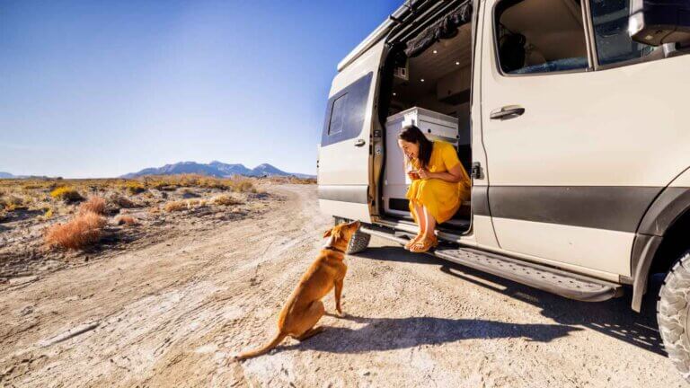
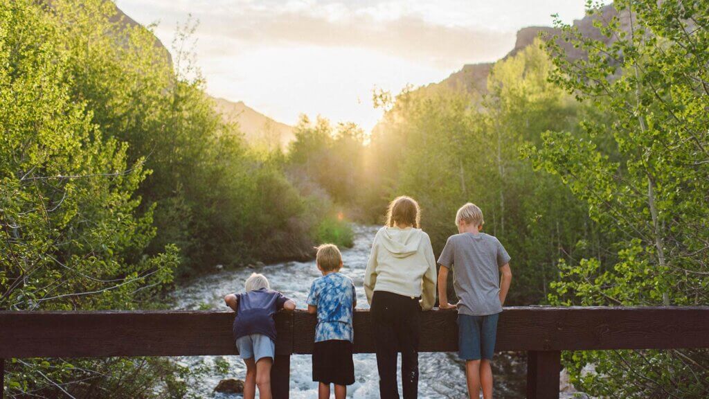
Nevada Camping: Tried-and-True Spots for Ultimate R&R
Whether you want to be tenting it up beside a trout-packed alpine lake, overlanding under the most spectacular stargazing you’ve ever experienced, or pulling the RV into a beautiful park, Nevada offers seemingly endless choices for every camping style.
The Silver State’s unbeatable variety of unspoiled landscapes—and lack of other people—pretty much guarantees you the off-grid solace you seek when camping.
Scope out this snapshot of some tried-and-true Nevada camping destinations to get your motor running, as well as the specs you need to know to get out there.
Stake your Nevada camping spot at some of our favorite places
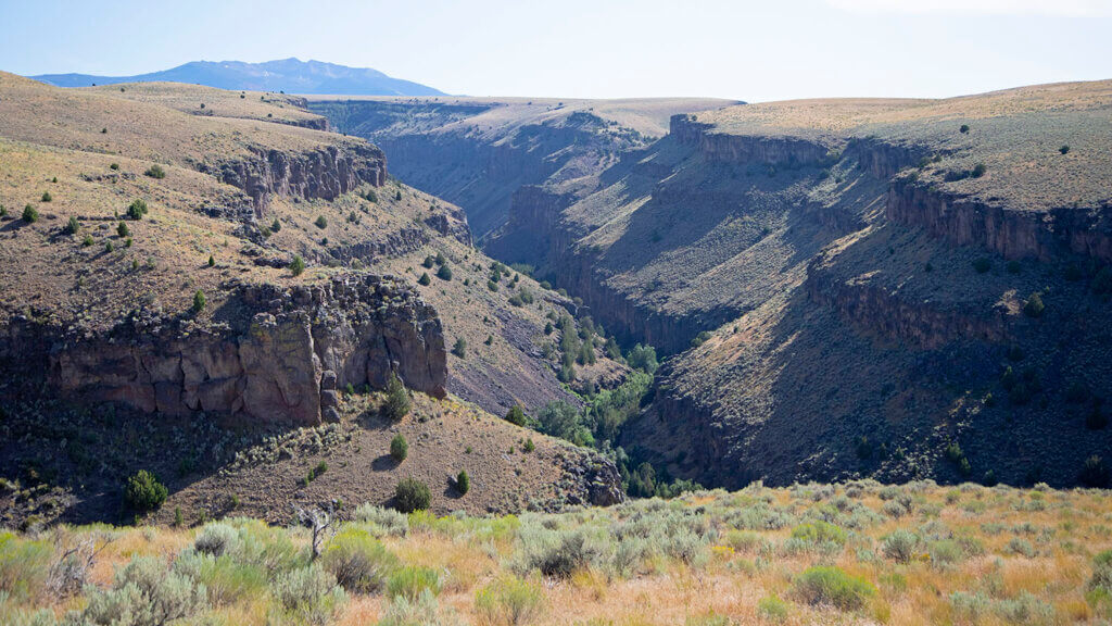
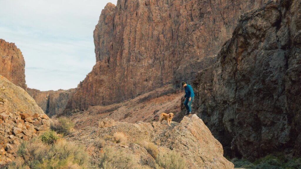
Equal parts mystery and grandeur, the Jarbidge Wilderness Area is an echelon of enchanting in its own class, honestly. Not only situated on the tippy-top northeastern Nevada border, this place is also at the top of the list of gotta-see-it destinations for outsiders and locals alike. So remote that most Nevadans haven’t even visited, the historic Jarbidge townsite is said to be one of the most isolated towns in the Lower 48—trust us, you can feel it when you’re here, too. Throwing off magical mystical vibes from high desert basin and range topography all the way down into a series of 6,000-foot-deep gorges, there’s plenty to get after in all 113,000 acres of rugged, can’t-believe-this-is-really-Nevada landscapes.
Head for the town of Jarbidge—a place just as legendary as the wilderness that surrounds it—then beeline it south of town to the Pine Creek Campground. The deeper you can get into this incredible campsite, the better, but just about all of the dozen-or-so sites serve up Jarbidge River-adjacent spots, fire rings, and picnic tables. If you set up shop here and never left, it would be a perfect trip (don’t forget about those storied Dolly Vardens in that river), or you can basecamp here and pick off seven peaks in the Jarbidge Mountain Range—Jarbidge Peak, Jumbo Peak, Square Top, The Matterhorn, Prospect Peak, Cougar Peak and Government Peak…Mary’s River and God’s Pocket too, if you’re really serious. While you’re at it, keep an eye out for the most serious outdoorsmen in the state, and Bascos, their modern-day sheep camps, and arborglyphs that prove they’re the real experts in this neck of Nevada.
Are we talkin’ northern, southern, or central Nevada? Northeastern Nevada
Closest town to snag amenities: Elko
Road condition: 68 miles of dirt roads – AWD or 4WD recommended
Cell signal situation? Nonexistent beyond Jarbidge townsite
Camp this way: Tent or trailer
Best time of year to swing through: Summer and fall
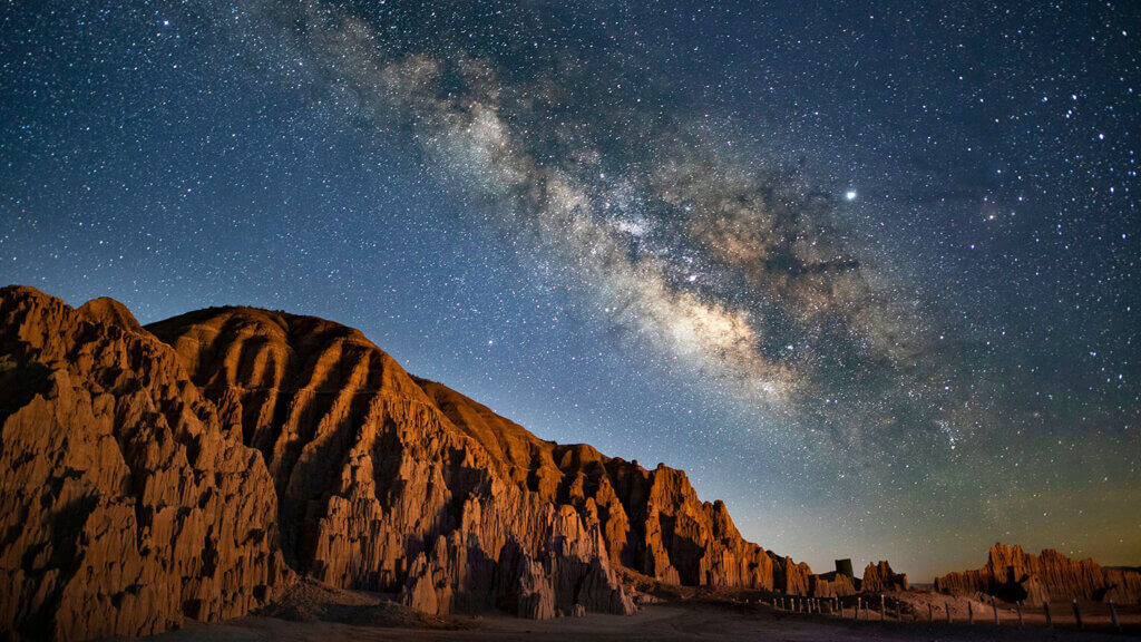
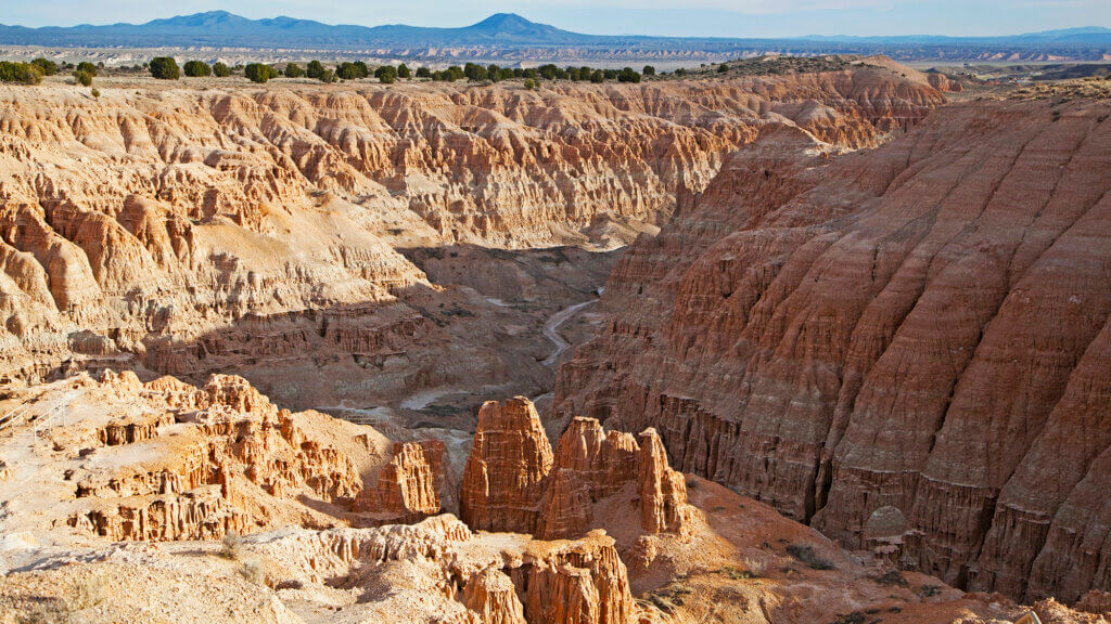
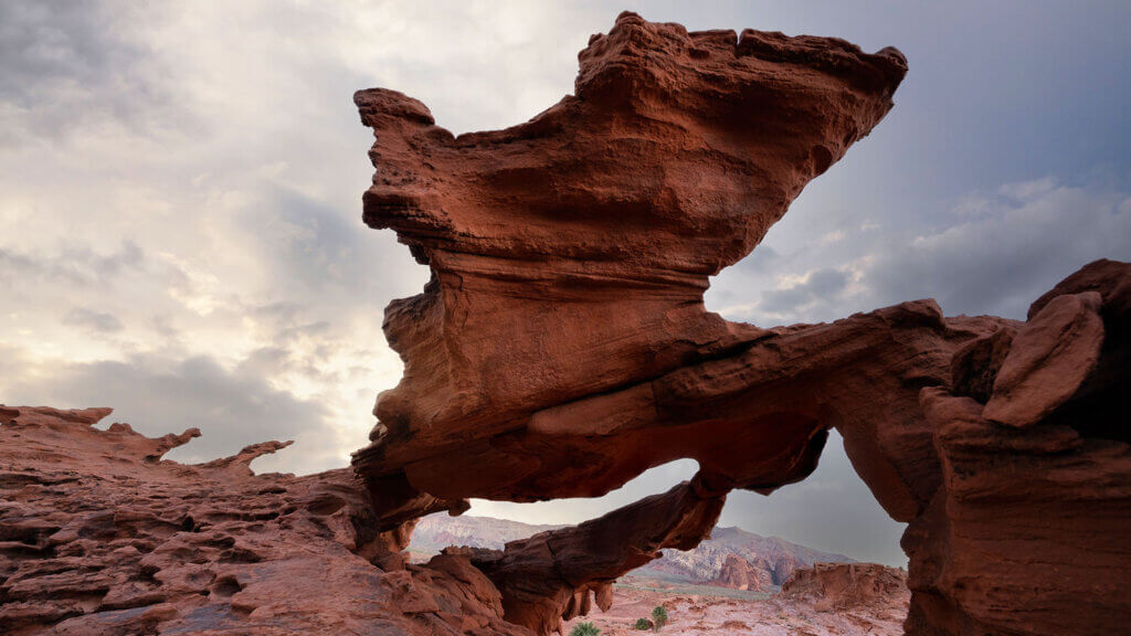
Speaking of gorge-ous, say hello to the insanely beautiful Cathedral Gorge State Park— the golden goose of Nevada slot canyons. Though it’s surrounded by Nevada’s biggest pocket of parks—and it’s really worth checking all of them out—this one is a natural front-runner because of its out-of-this-world spiry formations and slot canyons that have been part of the southern Nevada landscape for millions of years. Imagine finding this place as a pioneer! You’re driving your wagon along and then all of a sudden—amazing drops into jagged formations that reminded some of a cathedral. It has a way of pulling some wild imagination out of everyone who visits, and is a place so great you won’t ever want to hit the road.
Lucky for you, this Nevada State Park has some of the very best camping of the bunch, which means you won’t have to say goodbye ’til you’re really ready. Choose from 22 sites, all within walking distance of every major attraction within the park and each equipped with shade, fire rings, and best of all: super nice coin-operated shower setups. Spend all your time in the slots, or use Cathedral as your basecamp when exploring all six state parks in the area.
Are we talkin’ northern, southern, or central Nevada? Southern Nevada
Closest town to snag amenities: Caliente
Road condition: Paved entirely – 2WD all day
Cell signal situation? Full service
Camp this way: Tent, trailer, or RV
Best time of year to swing through: Spring, fall, or winter
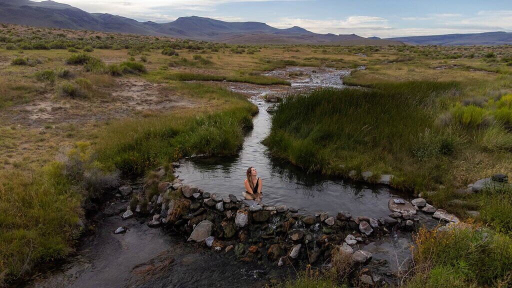
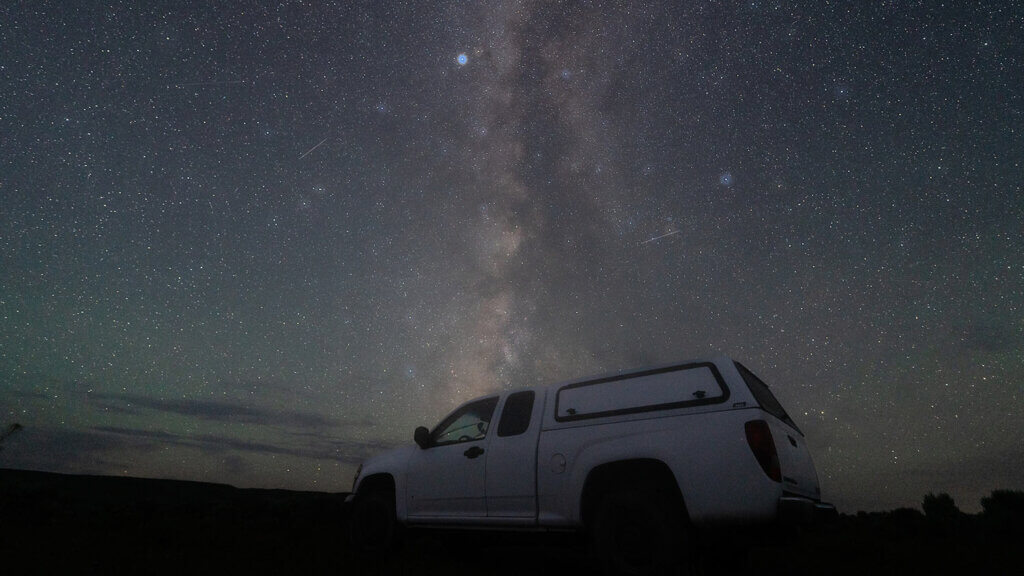
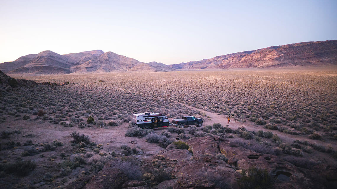
Hot springs and camping—is there a better duo? We don’t think so, and in a state with more public lands and hot springs than most, the Soldier Meadows experience is an unbeatable one. Color and beauty is all around you in the Black Rock Desert—you’ve just got to look for it.
The Black Rock Desert is one of the largest open spaces in the world (1.2 million acres, to be exact) that includes 10 wilderness areas you can find yourself in—including Soldier Meadows— all while not running into another single person. Here, vistas go on for miles, vastness can sometimes overwhelm in all the right ways, and there’s nowhere better to redefine solitude. Protected by proximity, you’ve gotta work a bit to access the place, but once you do: plan for a massive concentration of public lands hot springs, staggering canyons, and one of the best places in the country to really enjoy truly dark skies. The stars up here—specifically at Massacre Rim, but really anywhere in the Black Rock—are so bright, navigating to a hot spring by way of starlight is an actual thing. Sink into the actual rivers of hot springs, pooled up since the pioneers came through, then settle into a half dozen primitive Bureau of Land Management (BLM) campsites within walking distance. Or if you’re especially lucky, BLM-managed Soldier Meadows Cabin will be vacant and all yours.
Are we talkin’ northern, southern, or central Nevada? Northwestern Nevada
Closest town to snag amenities: Gerlach, depending on what you need
Road condition: Paved until the playa, then dirt roads – 4WD or AWD recommended
Cell signal situation? Nonexistent beyond Gerlach
Camp this way: Tent or pickup bed
Best time of year to swing through: Spring, summer, or fall
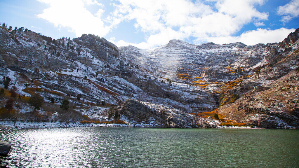
“The air up there in the clouds is very pure and fine, bracing and delicious. And why shouldn’t it be?—it is the same air angels breathe.” Mark Twain was talking about another iconic Nevada lake, but considering Angel Lake is a whole 2,000+ feet in elevation higher, it doesn’t get a whole lot more heavenly than this.
Situated in the unbelievably pristine East Humboldts just outside Wells, Angel Lake is textbook Nevada alpine lake, and an amazing basecamp for any outdoorsmen looking to access this range, and the eastside of the Rubies. There are about a dozen spots at Angel Lake with access to trails, restrooms, and of course the lake itself, which makes for perfect float tube fishing. If being a little closer to town and amenities is more your speed, check out the Angel Creek Campground a few miles back down the mountain, nestled in shady trees with the relaxing bubbling of Angel Creek, which flows through the campground.
Are we talkin’ northern, southern, or central Nevada? Northern Nevada
Closest town to snag amenities: Wells
Road condition: Paved entirely – 2WD all day
Cell signal situation? Hit or miss beyond Wells
Camp this way: Tent, trailer, or RV
Best time of year to swing through: Spring, summer, or fall – no winter access
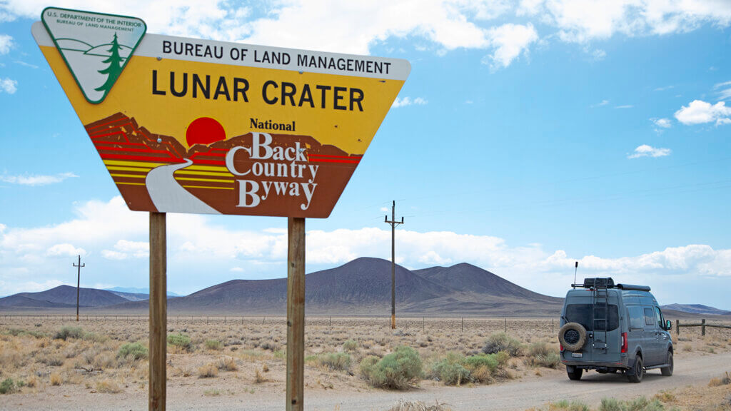
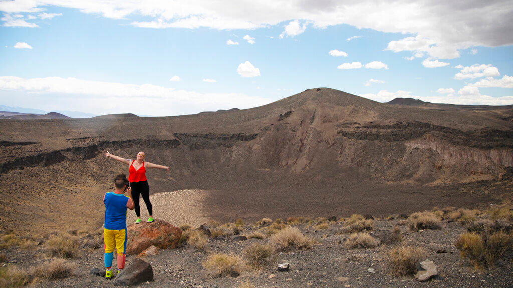
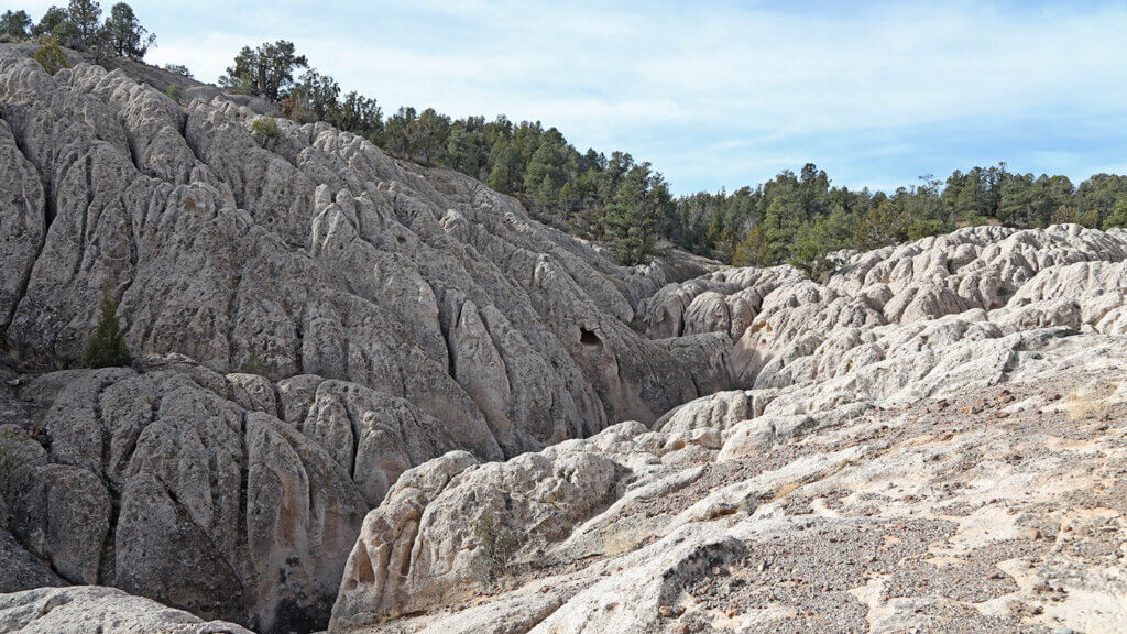
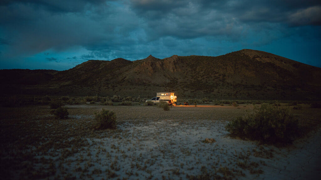
Camping in ancient lava beds. Yeah, let that one marinate for a minute. As if lava beds and the largest natural crater in Nevada aren’t dialing in those supernatural vibes, everything happening along the Extraterrestrial Highway will, which is about 35 miles away from this glorious place. There are all kinds of energies channeling the mysterious unknown in this part of Nevada. But the Lunar Crater Backcountry Byway? Really swingin’ for the fences—or atmosphere.
Formed by explosive eruptions close to ground level that merged liquid hot magma with groundwater, this massive crater is surrounded by 20 extinct volcanoes and lava beds. So lunar-like, even Buzz Aldrin and Neil Armstrong bounced around this place while training for real missions to the moon. Do the whole 24-mile scenic loop, snap tons of photos, then stake out a primitive, dry camping spot in the lava beds. It’s BLM land, so pretty much anywhere goes.
Travel Nevada Pro Tip
Leave yourself enough time to hike through the lava beds. Some lucky visitors have found giant chunks of obsidian lodged in the lava fragments.
Are we talkin’ northern, southern, or central Nevada? Central Nevada
Closest town to snag amenities: Tonopah
Road condition: Paved entirely, except for the byway itself – 2WD all day
Cell signal situation? Hit or miss depending on cell service provider
Camp this way: Tent or trailer
Best time of year to swing through: Spring, summer, or fall
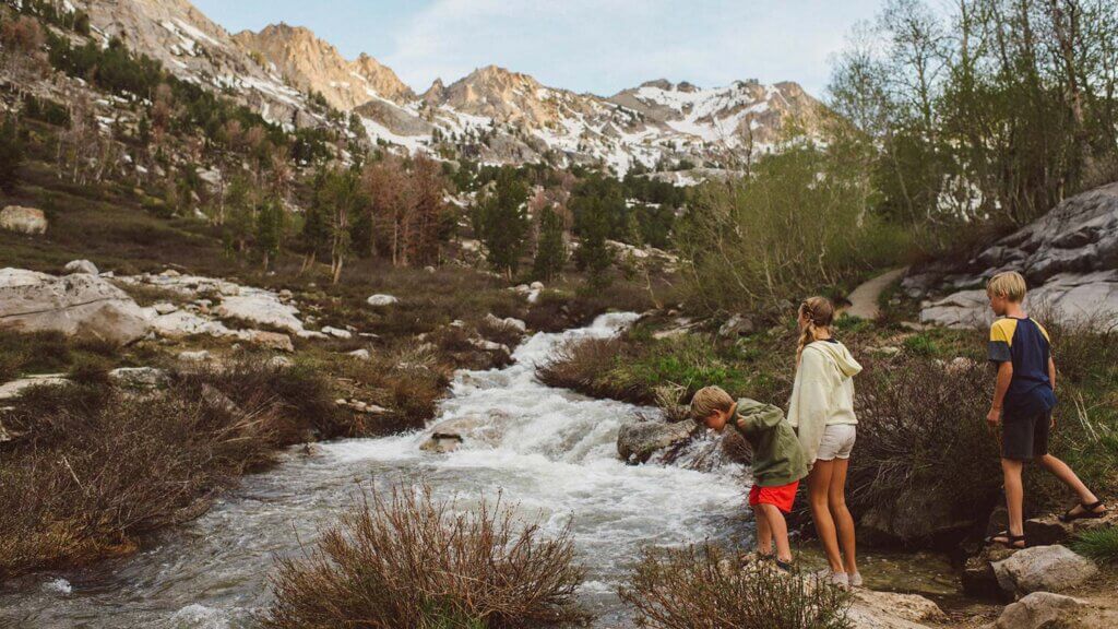
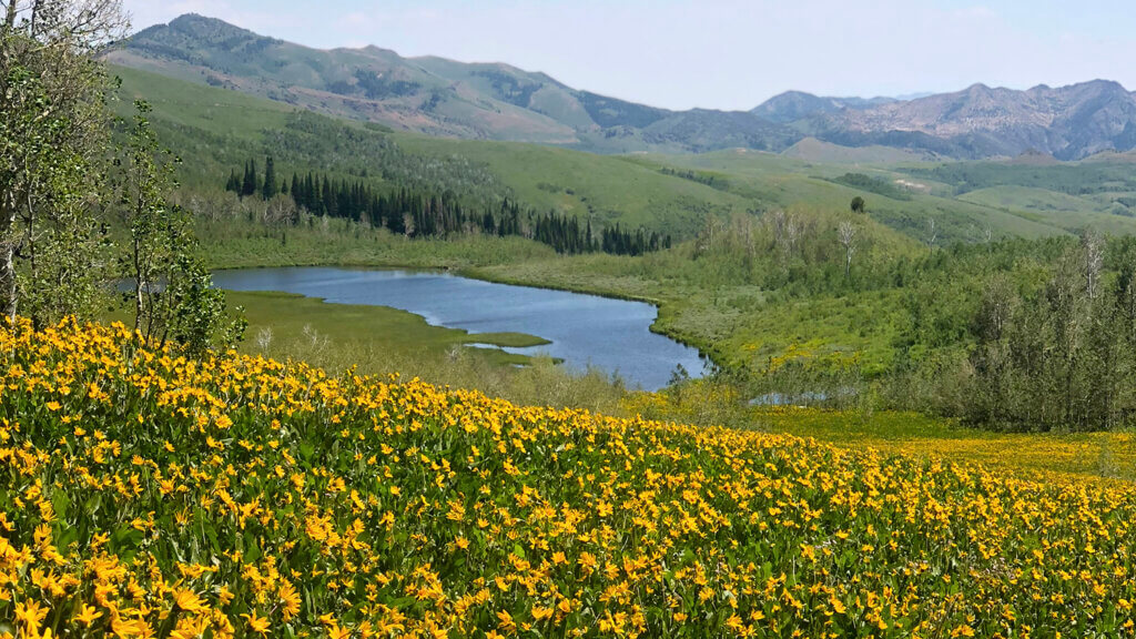
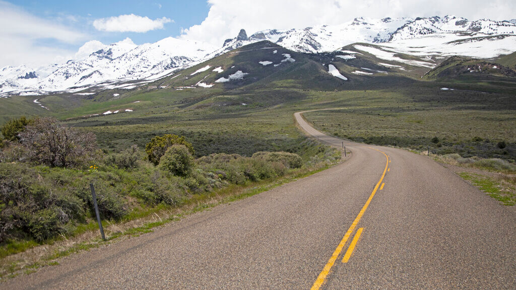
Do we even need to sell this place with a picture like THAT? Sometimes called the “Swiss Alps of Nevada,” this incredibly gorgeous glacier-cut canyon is 20 minutes south of Elko. Though the Ruby Mountains stretch about 90 miles, Lamoille Canyon itself offers up some of the best access points to this spectacular wilderness area, as well as all-around, any-skill-can-do-it camping. If you’re up for a backpacking overnighter, these mountains are known for impressive pockets of alpine lakes with Carribbeanesque quality, giving Tahoe a run for its money.
Drive the 12-mile long Lamoille Canyon Scenic Byway to the end, where you can access Island, Dollar, Lamoille, and Liberty Lakes and beyond. This is also a starting (or ending point) of the Ruby Crest National Recreation Trail if you’re down for a 43-mile expedition. If you’re not looking to bite off that caliber of camping, snag a spot in the Thomas Canyon Campground—right around the sixth mile into the Lamoille Canyon Scenic Byway. Access opens around Memorial Day with unbelievable wildflower blooms that always make summer a memorable time to be in the canyon—and the fall? A kaleidoscope of colors you won’t soon forget.
Are we talkin’ northern, southern, or central Nevada? Northern Nevada
Closest town to snag amenities: Elko
Road condition: Paved entirely – 2WD all day
Cell signal situation? Not much signal within the canyon
Camp this way: Tent, trailer, RV, or backpack in
Best time of year to swing through: Spring, summer, or fall – no winter access in the canyon
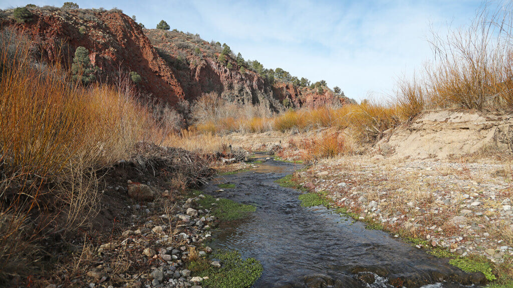
If you’re in need of a true off-grid reset, we can’t think of a much better qualifier than a campout at Beaver Dam State Park. It’s considered one of the most remote state parks in Nevada, and the area’s deep canyons, thickly wooded forests, flowing streams, and waterfalls—and sightings of beavers at work—are sure to impress the nature lover in all of us. If you’re hoping for a real deal escape that doesn’t involve a whole lotta human interaction, you’ve just found your park. Of all the times we’ve been here—we’re talkin’ hiking trails, fishing holes, and the campground itself—we’ve seen about a half dozen people, max. Best yet, the campsites feature spacious tent pads, parking for one vehicle and small trailer, and super clean restrooms. Situated in southeastern Nevada just outside Caliente (and about a mile from the Utah border), straight up redefined serenity is what this place translates to, even in “peak” season.
Are we talkin’ northern, southern, or central Nevada? Southern Nevada
Closest town to snag amenities: Caliente
Road condition: 28 miles of dirt road driving – 4WD or AWD recommended
Cell signal situation? Nonexistent beyond park turnoff
Camp this way: Tent or trailer
Best time of year to swing through: All four seasons aim to please!
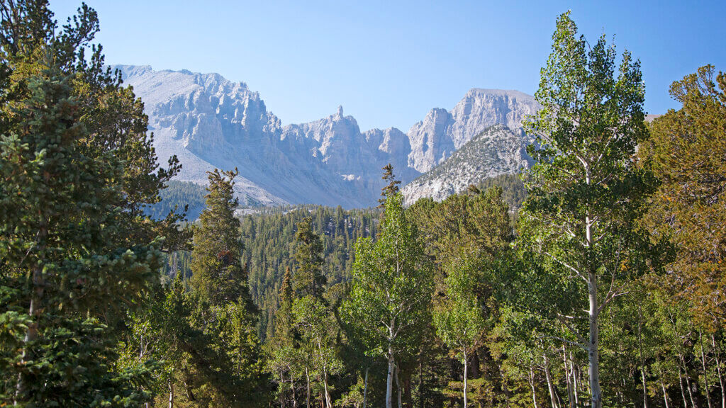
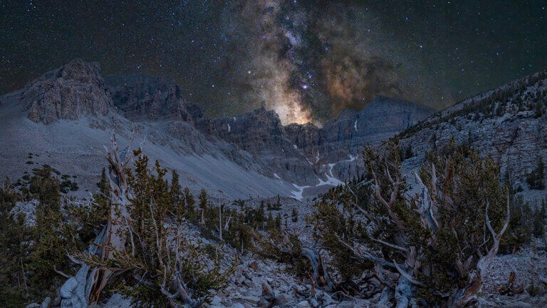
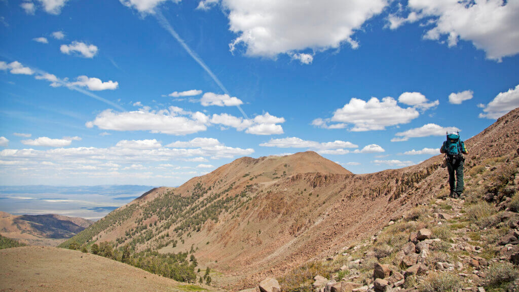
After you set up camp at the 10,000-foot-elevation Wheeler Peak Campground, realizing Great Basin National Park is one of the least visited national parks will bring on a deep range of emotion. Maybe even most of the stages of grief: shock, then denial the site was open, anger knowing nobody else is here seeing what you’re seeing, then blissful acceptance that you get this place all to yourself. People often miss this place, thinking they’ve experienced Great Basin from the highway or not seeing something from that vantage point to draw them in. But the good stuff, like Nevada’s second tallest peak, the impressively intricate Lehman Caves, bristlecone pines, and dazzling stargazing is the stuff that quickly makes you realize, “OK, now I get why it’s a national park.” That epiphany usually goes down AT Wheeler Peak Campground.
Aside from rolling out of your tent to THE best views of Wheeler, Doso Doyabi Peak, and the entirety of the range that defines the park, camping at Wheeler Peak Campground promises one amazing scenic drive, access trails to ancient bristlecone groves, Wheeler Peak itself, and other natural features that put this place on the map. You can’t go wrong stargazing from anywhere within the park, but posting up at this campground launches you 3,000 feet higher into the sky than at the visitors center. In our book, that matters.
Are we talkin’ northern, southern, or central Nevada? Eastern Nevada
Closest town to snag amenities: Ely
Road condition: Paved entirely – 2WD all day
Cell signal situation? Surprisingly good, depending on cell service provider
Camp this way: Tent, trailer, or RV
Best time of year to swing through: Summer or fall – no winter access above 10K elevation
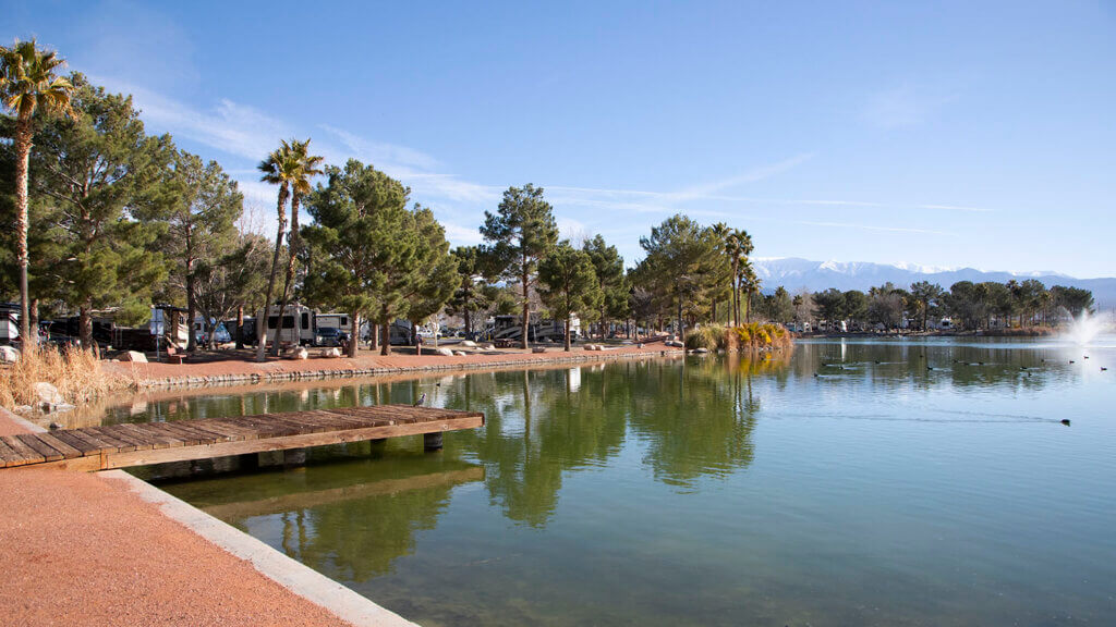
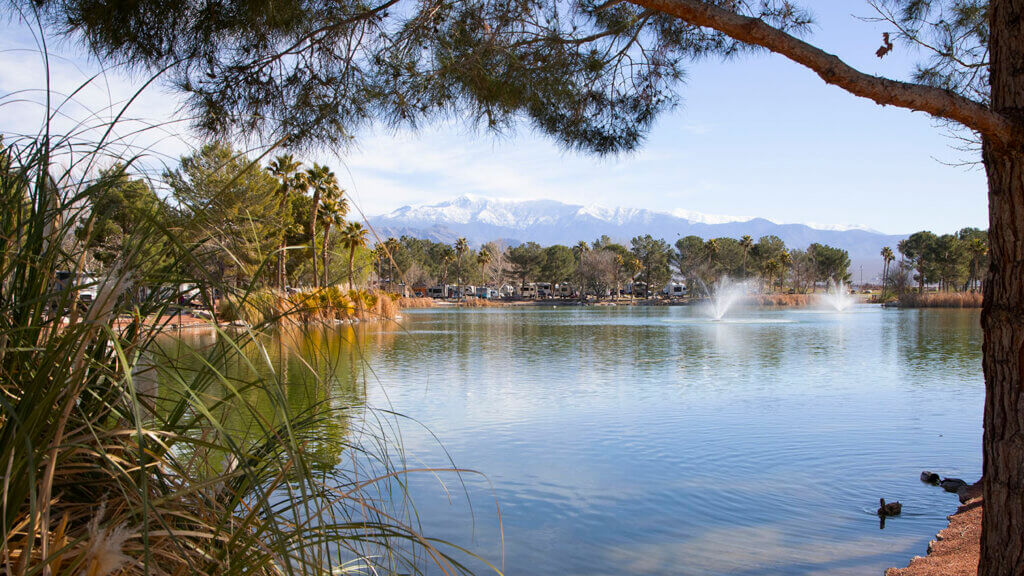
If you’re rolling eight wheels deep and looking for a killer place to basecamp while in proximity to a place people from around the globe travel to—a little ol’ destination called Death Valley National Park—Pahrump’s Lakeside RV is where it’s at. With narrow perfect-weather windows, visiting the lowest, hottest, and driest place in North America requires some creature comforts, and Pahrump has the RV park scene totally nailed, with Lakeside RV a frontrunner.
With Mt. Charleston (Nevada’s fifth tallest peak) towering over Lakeside RV in the distance, and a place 282 feet below sea level in the other direction, road tripping this part of Nevada along the Death Valley Rally means traveling through seven climate zones, equivalent to traveling from Mexico to Canada. When pulling your rig into one of 159 full-service hookup sites, it will become clear why desert explorers call this oasis in a land of extremes their homebase. Named Lakeside, you better believe there’s a lake: seven whole acres of lakeside RV spots, to be exact. Also serving up a swimming pool, hot tubs, kayaks, pedal boats, fishing, nine-hole frisbee golf, horseshoes, a beach cabana, and an entire casino floor, the amenities are certainly not sparse around here.
Are we talkin’ northern, southern, or central Nevada? Southern Nevada
Closest town to snag amenities: Pahrump
Road condition: Paved entirely – 2WD all day
Cell signal situation? Full service
Camp this way: Trailer or RV
Best time of year to swing through: Spring, fall, or winter
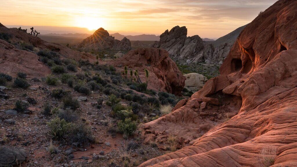
Camp beneath starry skies, get your ghost town fix, stare down the Devil’s Throat, appreciate the most impressive petroglyph panels, and get to know Nevada’s piece of the Grand Canyon—all at Gold Butte.
While thousands upon thousands of visitors head for Valley of Fire, Gold Butte quietly sits directly across the basin on the back side of Lake Mead, almost hidden in plain sight—despite vibrant sandstorms frozen in time and formations equally as impressive, if not more. Primitive, dry camping at Whitney Pocket is the easiest access point and sure to please, and if you’ve got a serious adventure rig in the wings, Little Finland never, ever disappoints. We’re all about camping in beautiful places, but being in a place where you can feel its geological and historical importance? That’s the stuff Nevada camping dreams are made of.
Are we talkin’ northern, southern, or central Nevada? Southern Nevada
Closest town to snag amenities: Mesquite
Road condition: Really rough once-paved-asphalt-turned-dirt – definitely do not access without 4WD
Cell signal situation? Nonexistent beyond Mesquite
Camp this way: Tent
Best time of year to swing through: Spring, fall, or winter – with temps above 120 degrees, hard no on summer access
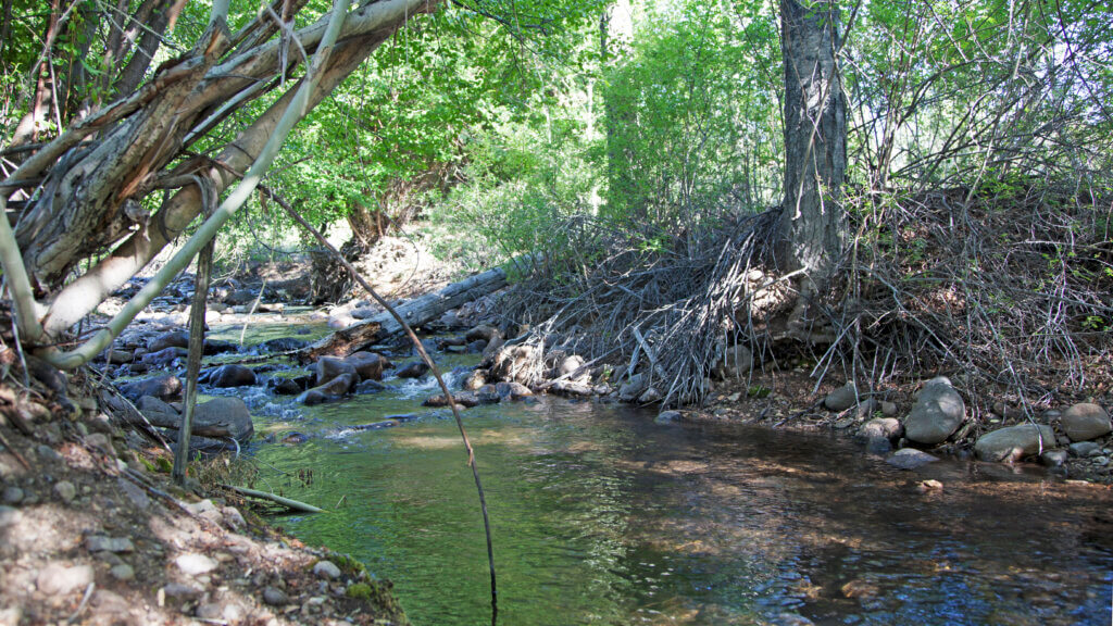
A place known for its “extreme alpine conditions” and home to the tallest peak in central Nevada (the fourth tallest in the state). If that’s not enough to get you here for the amazing camping and all-around tranquility, what will? This off-grid hideout is a definite favorite for most Nevadans who know what’s up, particularly those who live by the Dirt Road Code. Like it’s almost hidden in plain sight, the Alta-Toquima Wilderness isn’t far from the geographic center of the state and has been staring at you all this time without you even realizing it.
There are three summits within—North, Middle and South, with the South being the tallest and called Mount Jefferson. Choose one of the most memorable spots you’ll camp at within Pine Creek Campground, situated at the base of the trailhead. Here, well-maintained campgrounds and restrooms are tucked into lush scenery, and you’re likely to bump into some Nevadans who covet the sacredness the place holds. If you’re up for a bigger adventure, summit the mountain or backpack into the Sawmill Campground, which is a hunter-maintained campground about halfway to the peak. On the way, you’ll cross Pine Creek about a half dozen times, get to know the region’s rich Basque culture by way of 90-year-old tree carvings, and maybe even see some Desert Bighorn Sheep—after all, they thrive better here in this elevation than any other spot in the world.
Are we talkin’ northern, southern, or central Nevada? Central Nevada, close to the geographic center
Closest town to snag amenities: Tonopah
Road condition: Well-maintained dirt roads
Cell signal situation? Nonexistent beyond south of Highway 50 or north of Tonopah
Camp this way: Tent or backpack in
Best time of year to swing through: Summer
The Elbow Unit at the East Walker River
Yerington or Hawthorne
Find it off the Free-Range Art Highway road trip
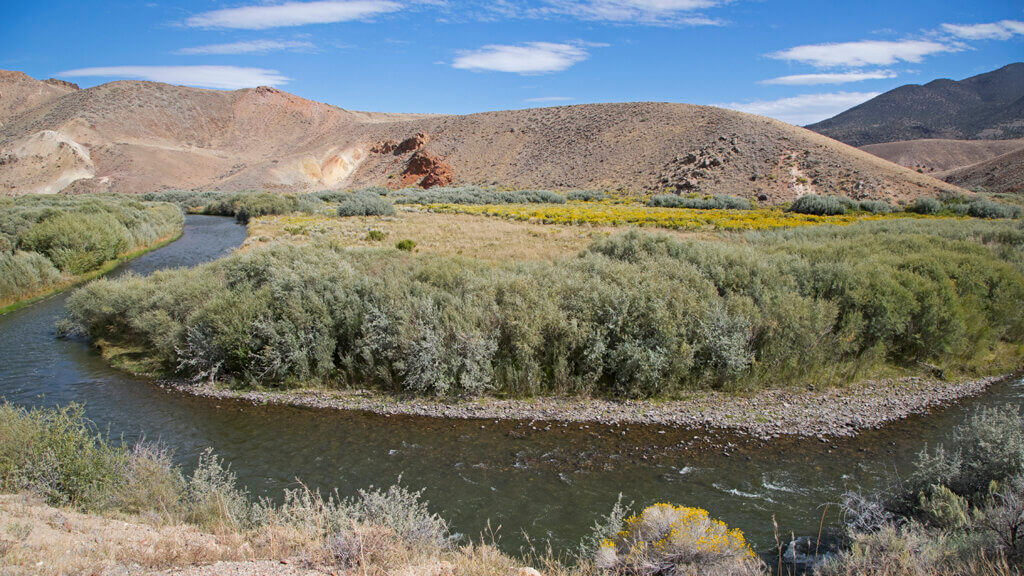
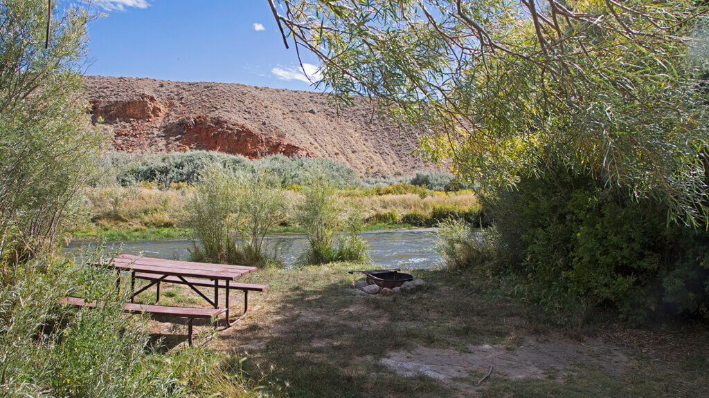
A place so special it gives the word “legendary” a run for its money, this unspoiled section of the East Fork of the Walker River—fabled among fly fishermen for decades—remains pristine and primitive. One of four parts to the Walker River State Recreation complex, this beautiful, storied bend in the river is called “The Elbow”—just like someone’s arm cupped to their mouth whispering to you, “Come fish this secret river filled with giant trout.” This particular section of the park is known for world-class fishing, but the entire 29 miles of picturesque river within captures the attention of kayakers, birdwatchers, and of course campers from near and far.
The Walker River State Recreation Area is big—the largest of all Nevada State Parks—covering a hard-to-believe 12,000 acres of land. Set up camp at The Elbow in the Bighorn Campground, choosing from nearly two dozen spots that set the stage for pretty incredible recreation. Say you’re one of the few who’s fished this mythical stretch, then be sure to check out 9 Mile Ranch—the oldest building in the county, tucked in a region of Nevada so special, it made the cut for Twain’s time in Nevada in his book Roughing It.
Are we talkin’ northern, southern, or central Nevada? Northern Nevada
Closest town to snag amenities: Yerington or Hawthorne
Road condition: Well-maintained dirt roads – 2WD all day
Cell signal situation? Hit or miss depending on cell service provider
Camp this way: Tent or trailer
Best time of year to swing through: Summer or fall
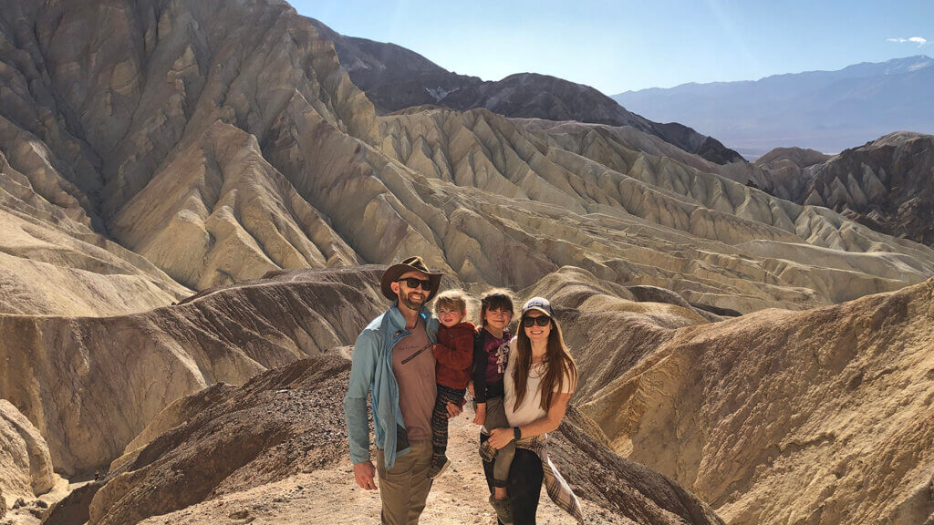
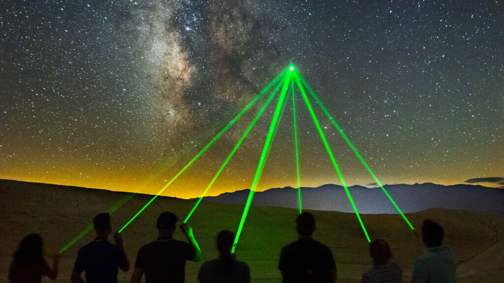
While the rest of the state is starting to freeze, Death Valley is gearing up for primetime camping season: fall and winter. Sure, this state-straddling, low desert national park can get pretty nippy at night, but all those dreamy hikes within the park are actually possible this time of year. Sink those stakes into the Furnace Creek Campground, then brace yourself for one mind-blowing camping trip that puts you in places you can’t reach when it’s 130 degrees out. Telescope Peak, Zabriskie Point, Golden Canyon, Natural Bridge, and Titus Canyon are all hikes within definite reach during fall and winter months, and that cooler crisp air seems to make those dark skies seem even darker for ideal stargazing conditions at camp.
Are we talkin’ northern, southern, or central Nevada? Southern Nevada
Closest town to snag amenities: Beatty or Pahrump
Road condition: Paved entirely – 2WD all day
Cell signal situation? Hit or miss depending on cell service provider
Camp this way: Tent, trailer, or RV
Best time of year to swing through: Spring, fall, or winter – with temps above 120 degrees, hard no on summer access
The sky’s the limit when it comes to enjoying Nevada’s still wild, unfenced, vastly freeing public lands. Some things require a permit (think hunting, fishing, and some other specialized hobbies), but one thing sure as heck doesn’t: camping. Yet another thing that makes the Silver State different than any other, the BLM manages nearly 50 million acres of land in Nevada, AKA almost the entire state. If you have to enter a gate, that probably means it’s private, and always keep an eye out for people who’ve built fire rings before you instead of trying to make one of your own. But chances are that gorgeous valley, stunning overlook, or public hot spring is on BLM land, and you can settle in with those coyote lullabies for all the way up to 14 days if you really want to. Get out there and camp like you mean it—the fresh air is waiting for you.